ATGVIDEO
Home
Hot video
Now watching
Search
News
Sport
Music
Games
Humor
Animals
Movies
Auto
Home
Geospatial World
Geospatial World
Latest Videos
Location Intelligence for Crime Hotspot Identification
40% Faster BIM Model Construction of Changi Airport Using Reality Capture
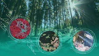
Tracking Deforestation with Space Tech #climatetech#deforestation #spacetechnology
IGNs Integration of PlanetSAT Imagery Revolutionizes Geographic Insights
Next-Gen Solution to Improve PNT Security Capabilities
Embracing One and All Journey of Geospatial Through Time
Webinar on Trimble DA2 GNSS Receiver Unleashing the Power Of Accuracy in India
Webinar on Visualizing Spatial Data at Scale with Tableau Kinetica
Tracking Global Deforestation from Space
History of Drones in Conflict Zones
What is Geofencing and How Does it Works?
Why Indoor Maps are critical in case of emergency
What is Geospatial Intelligence or GEOINT?
Use of SAR data to Understand and Mitigate Natural Disasters
Webinar on Building Real - Time Location Intelligence Apps Kinetica
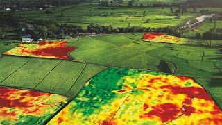
Applications of Remote Sensing in Precision Farming
SAR Satellites for Disaster Management
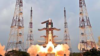
Top ISRO Launches to Watch Out in 2023
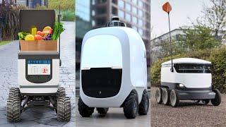
How Robots are being used for grocery delivery
How AI is Transforming Remote Sensing Applications
Top 5 industries being redefined by AI
Indo-Pacific GeoIntelligence 2023 Conference Promo Video
What is a Point Cloud?
What is LoRaWAN Technology?
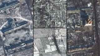
Satellite Imagery Shows Heavy Russian Losses in Donbass Mining Town
Five Benefits of Using Digital Twin in Construction Industry
What are the Five Free Sources of LiDAR Data?
Four Most Effective Anti-Drone Techniques
Turkey Earthquake Before and After Satellite Images Show Extent of Destruction
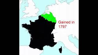
Territorial evolution of France from 985 AD to 1947
Drones for Agriculture in India
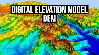
What is Digital Elevation Model or DEM?
Top 5 Supply Chain Trends For 2023
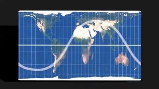
Why spacecraft orbits look like a sine wave on a flat map?
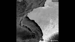
Iceberg A81 7 years condensed in 5 seconds. #shorts
Five ways Digitalization can help Build Global Resilience in 2023
Top 5 BIM Trends For 2023
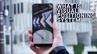
What is Visual Positioning System VPS?
Top Five Mobility Trends to See in 2023
What are the Five Types of Geographic Data?
Strategic Investments in Digital Twins Crucial for Bentley Acceleration Initiatives Santanu Das
2022 A Year in Review through Satellite Imageries
How Many Satellites are orbiting around Earth in 2022?
Top Five AI Trends to Look Out for in 2023
Top Five Uses of Drones in India
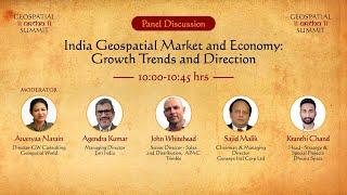
India Geospatial Market and Economy Growth Trends and Direction Geospatial Artha Summit 2022
Glimpses of Bentley Systems’ 2022 YII Conference
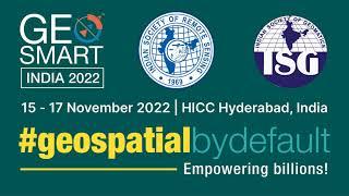
GeoSmart India 2022 15 - 17 November HICC Hyderabad India
Webinar on FJD Trion S1 3D LiDAR Scanner A New Way to Scan the World FJDynamics
UNWGIC 2022 Testimonial video